
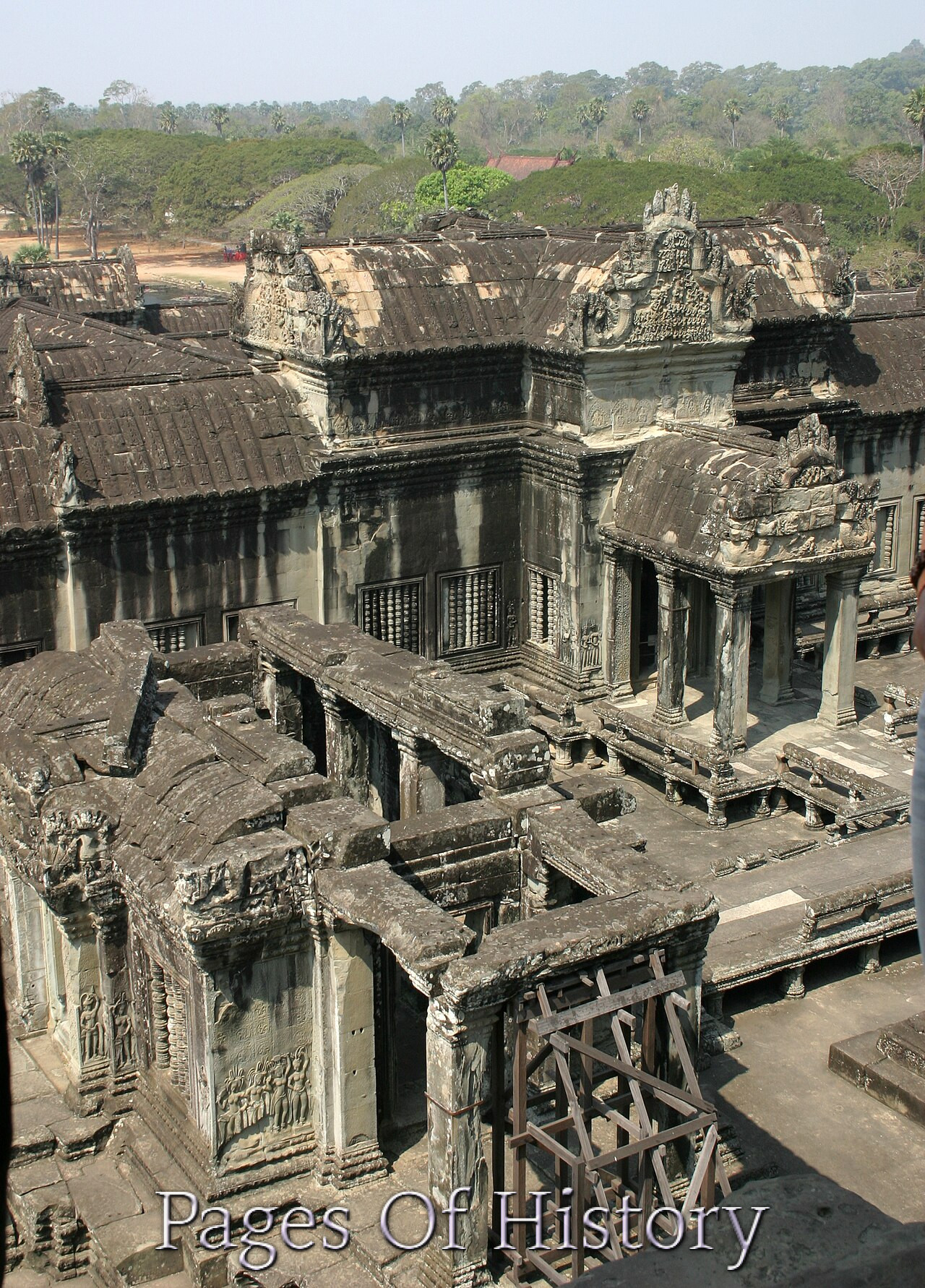
📅 Last updated: 28.08.2026
The question of the “Angkor Wat collapse” is not merely the story of a single temple falling into ruin, but a profound investigation into the fragility of great civilizations. The sprawling metropolis of Angkor, of which Angkor Wat is the most iconic jewel, was not simply abandoned; it was a complex, living engine of power, faith, and hydrology that eventually reached a breaking point. For centuries, it was the largest urban complex in the pre-industrial world, a city of stone and water that housed hundreds of thousands of people. Yet, by the early 15th century, its power had waned, its canals had silted up, and its kings had departed, leaving the jungle to slowly reclaim its monumental architecture. To understand why this happened, we must look beyond the romantic image of a lost city and into the intricate interplay of climate, engineering, and geopolitics that ultimately spelled its doom.
- The Architectural Miracle and the Hydraulic City
- The Golden Age and the Seeds of Decline
- The Great Climate Shift: Drought and Deluge
- The Strategic Failure of the Water Grid
- Geopolitical Pressure and the Rise of Ayutthaya
- The Final Abandonment: A Capital Moved to Phnom Penh
- Rethinking the "Collapse": What Angkor's Fall Really Teaches Us
- The Eternal Lesson of a Vanished City
The Architectural Miracle and the Hydraulic City
To understand the fall, one must first grasp the sheer scale of the achievement. Founded in the late 9th century by King Yasovarman I, the Angkorian capital was not a single city but a series of successive capitals built around the massive reservoir, or baray, of East Baray. However, it was in the 12th century that the Khmer Empire reached its zenith. Under King Suryavarman II (reigned 1113–1150), the empire commanded vast territories across modern-day Cambodia, Thailand, Laos, and southern Vietnam. It was this king who commissioned Angkor Wat in the early 12th century as his state temple and funerary mausoleum. Dedicated to the Hindu god Vishnu, the temple’s five central towers were designed to represent Mount Meru, the mythical home of the gods. It was not merely a religious monument; it was a cosmic anchor for the king’s divine authority on earth.
The true genius of Angkor, however, lay not in its stone temples but in its invisible infrastructure. The city was a vast “hydraulic state,” a sophisticated network of canals, moats, and reservoirs designed to manage the seasonal monsoon. The Tonlé Sap Lake, which expands and contracts dramatically with the seasons, was the primary engine of rice production. But to support a population of perhaps 750,000 to one million people, the Khmer engineers built a massive water management system that diverted water from the Puok, Roluos, and Siem Reap rivers. The West Baray, a reservoir measuring 8 kilometers by 2.2 kilometers, holds nearly 50 million cubic meters of water. These structures were not just for irrigation; they were integral to the city’s defense, its religious symbolism, and its social order. The king controlled the water, and the water controlled the harvest, and the harvest fed the army and the builders. This delicate balance was the empire’s greatest strength and, as we shall see, its fatal vulnerability.
The Golden Age and the Seeds of Decline
The century following the construction of Angkor Wat was one of intense building and expansion. The reign of Jayavarman VII (r. 1181–1218) marked the final great burst of Khmer power. After repelling an invasion by the Champa kingdom in 1177, Jayavarman VII rebuilt the capital, constructing the walled city of Angkor Thom and its centerpiece, the Bayon temple, with its serene, gigantic faces of the Bodhisattva Avalokiteshvara. He also built the temple of Ta Prohm, the Preah Khan, and a staggering network of roads and hospitals that stretched across the empire. This was a period of immense wealth and religious transformation, as the state shifted from Hinduism to Mahayana Buddhism, reflecting the king’s personal devotion.
Yet, this relentless construction was also a massive drain on resources. The sheer manpower required to quarry, carve, and transport millions of sandstone blocks from the Kulen hills, over 40 kilometers away, was immense. The state required a constant flow of tribute, corvée labor, and taxation from its provinces. Jayavarman VII’s projects were so vast that his own inscriptions state that he suffered from a “painful disease” from the sheer weight of his responsibilities. This era of monumental ambition created a structural strain on the empire’s economy and its agricultural base. The state was becoming too complex, too centralized, and too dependent on the constant expansion of its water network. When the expansion stopped, the system would begin to stagnate.
The Great Climate Shift: Drought and Deluge
For decades, historians debated the causes of the Angkor collapse, often pointing to foreign invasions or the spread of Theravada Buddhism as a pacifying force. However, the most compelling evidence points to a far more impersonal culprit: the climate. In the 2010s, a breakthrough study by an international team of scientists, led by Brendan Buckley of Columbia University’s Lamont-Doherty Earth Observatory, analyzed tree rings from the region’s long-lived cypress trees. The data they uncovered painted a stark picture of a “mega-drought” that gripped the region from roughly 1345 to 1362, followed by a series of shorter, but still severe, dry spells that lasted until the 1420s. These were not just a few bad seasons; they were multi-decade periods of failure that would have crippled the Angkorian water management system.
The problem was not just the lack of rain. The Khmer water network was designed to handle the predictable rhythms of the monsoon. It relied on a delicate balance: the reservoirs would fill during the wet season and gradually release water during the dry season. But the mega-drought disrupted this cycle. Canals and reservoirs dried up, leading to crop failures and famine. Then, paradoxically, the climate shifted to the opposite extreme. The tree-ring data also revealed periods of intense, torrential monsoon rains. When these heavy rains fell on a landscape already stressed by drought, the consequences were catastrophic. The water management system, designed for steady flows, was overwhelmed. The massive earthen dikes and dams, some of which were centuries old, were breached by flash floods, sending torrents of water and sediment cascading through the city. This caused the canals to silt up, rendering them unusable for irrigation and navigation. The city’s very lifeblood—its ability to control water—was broken.
The Strategic Failure of the Water Grid
This environmental stress was not a random act of nature; it was a failure of the city’s most critical infrastructure. The Angkorian water grid was not a single, unified system but a sprawling, organic network that had been built up piecemeal over four centuries. It was, in effect, a “sprawling, ad hoc network” that had grown so large and complex that it became impossible to maintain effectively. As the historian and architect Richard Engelhardt has argued, the system’s very success had made it brittle. The vast reservoirs, or baray, were prone to siltation. The massive inflow and outflow channels required constant dredging and maintenance. When the climate turned erratic, the state lacked the resources or the foresight to adapt. The labor force that had once been dedicated to maintaining the canals was likely redirected to the military or was simply decimated by famine.
The consequences were felt across all levels of society. The rice paddies, which relied on the controlled release of water, became less productive. The fishing grounds of the Tonlé Sap became harder to access as the channels that connected the city to the lake clogged with sediment. The result was a cascading economic crisis. The kings lost their primary source of legitimacy: their ability to guarantee prosperity through divine intervention and hydrological control. As the water failed, so too did the mandate of heaven. The intricate system that had supported the largest city in the medieval world became a liability, a gigantic, decaying monument to a way of life that could no longer be sustained.
Geopolitical Pressure and the Rise of Ayutthaya
While the environment was undermining the empire from within, external forces were applying pressure from without. The Khmer Empire had always been surrounded by rivals, but in the 13th and 14th centuries, a new power was rising in the west: the Thai kingdom of Ayutthaya. Founded in 1351 by King Ramathibodi I, Ayutthaya was a militaristic state that rapidly expanded its territory into the Chao Phraya River valley, encroaching on Khmer territory. The Khmers and the Thais engaged in a series of brutal wars for control of the region. The Khmer chronicles record the sack of Angkor by Ayutthayan forces in 1353 and again in 1393. These were not just border raids; they were full-scale invasions that threatened the capital itself.
The siege of 1431 is often cited as the definitive date of the city’s fall. The Ayutthayan army captured and looted Angkor, carrying off thousands of captives, artisans, and scholars. This was a devastating blow to the Khmer state’s prestige and its intellectual capital. But it’s crucial to understand that the invasion was not the sole cause of the collapse. The city was already severely weakened by the ecological and economic crises of the preceding decades. The population had likely shrunk significantly, and the state’s ability to raise an army to defend its capital was compromised. The invasion of 1431 was the final, decisive blow to a system that was already on life support. It was not the cause of death, but rather the executioner.
The Final Abandonment: A Capital Moved to Phnom Penh
Following the sack of 1431, the Khmer court made a momentous decision: to abandon the city of Angkor entirely. King Ponhea Yat (r. 1393–1463) relocated the capital south to Phnom Penh, a strategic trading post located at the confluence of the Mekong, Tonlé Sap, and Bassac rivers. This move was a tacit admission that the old capital was no longer defensible or economically viable. The new location was closer to the maritime trade routes that were becoming the lifeblood of Southeast Asian economies. The Khmer empire, which had once been an inland, agrarian power, was pivoting to become a coastal, commercial state. The move was a pragmatic survival strategy, but it sealed the fate of Angkor.
The city of Angkor was not “lost” in the sense of being unknown. It was never entirely forgotten. Monks continued to maintain Angkor Wat as a Buddhist pilgrimage site, and local villagers lived among the ruins. However, the great administrative and royal center was abandoned to the elements. The jungle, which had always been held at bay by the city’s sheer density, began to reclaim its territory. The silk-cotton trees and strangler figs took root in the sandstone joints, their roots prying apart the massive stones. The great reservoirs dried up and became grassy plains. The intricate system of canals and roads was swallowed by the forest. For over 400 years, the city slumbered, a ghost of its former self, known only to the local people and a handful of European missionaries and explorers who passed through the region.
| Period | Key Event | Impact on Angkor |
|---|---|---|
| 1113–1150 | Reign of Suryavarman II; construction of Angkor Wat | Zenith of Khmer power and architectural ambition; solidification of the hydraulic state. |
| 1181–1218 | Reign of Jayavarman VII; construction of Angkor Thom and Bayon | Final expansion of the city; massive investment in infrastructure that strains the state’s resources. |
| 1345–1362 | Mega-drought begins | Severe water shortages, crop failures, and the destabilization of the agricultural base. |
| 1353 & 1393 | Ayutthayan invasions | Sacking of the city; loss of prestige, population, and administrative capacity. |
| 1431 | Final fall of Angkor to Ayutthaya | Decisive defeat leading to the abandonment of the capital and the relocation to Phnom Penh. |
Rethinking the “Collapse”: What Angkor’s Fall Really Teaches Us
The story of Angkor’s decline is often framed as a dramatic collapse, a sudden and violent end. But modern archaeological research, particularly the use of lidar (Light Detection and Ranging) technology, has revealed a more nuanced picture. The lidar surveys, conducted in 2012 and 2015, have mapped the full extent of the city beneath the forest canopy, revealing a sprawling urban landscape that was far larger than previously imagined. They have shown that Angkor was not a single, centralized city but a vast, low-density urban complex that extended for hundreds of square kilometers. This new evidence suggests that the “collapse” was not a single event but a long, slow process of transformation. The urban population may have declined over decades, with people drifting away to smaller, more sustainable communities. The elites may have left first, followed by the artisans and merchants, and finally the farmers.
The abandonment of Angkor was a tragedy, but it was also an adaptation. The Khmer people did not vanish; they simply changed their way of life. The center of gravity shifted from the interior to the coast, where trade with China and other maritime powers offered new opportunities. The move to Phnom Penh was a strategic retreat, not a surrender. It was an acknowledgment that the old model of an inland, agrarian empire was no longer viable in a world that was becoming increasingly connected by sea. The legacy of Angkor, however, was not extinguished. The Khmer identity, its language, its artistic traditions, and its religious beliefs, were carried to the new capital. The magnificent temples of Angkor were preserved as a sacred site, a testament to the glory of the past and a source of national pride for the Cambodian people today.
The Eternal Lesson of a Vanished City
The “Angkor Wat collapse” is a haunting reminder that even the most magnificent civilizations are not immune to the forces of nature and the consequences of their own choices. The fate of Angkor was sealed by a combination of factors: an inflexible infrastructure, a changing climate, and relentless external pressure. The Khmer kings built a city that was a masterpiece of engineering and a monument to human ambition, but they built it on a delicate foundation that could not withstand the shocks of a changing world. Their great hydraulic network, a symbol of their power, became the instrument of their downfall when it could no longer adapt.
The story of Angkor is not just a tale of the past; it is a parable for the present. As modern societies face the challenges of climate change, resource scarcity, and the fragility of global supply chains, the echoes of Angkor are unmistakable. The city’s fate serves as a powerful warning about the dangers of over-centralization, the need for adaptive infrastructure, and the importance of building societies that are resilient to shocks, both natural and human-made. When we walk through the silent corridors of Angkor Wat, we are not just witnessing the ruins of a city; we are looking into a mirror, reflecting our own vulnerabilities and the eternal question of what it truly takes to build a civilization that can endure. The stones of Angkor whisper a profound lesson: that all empires are built on the shifting sands of time, and that the greatest monument to a society’s success is not its architecture, but its capacity to adapt and survive.